Cruising Guides
Cruising Guides – MD & DE
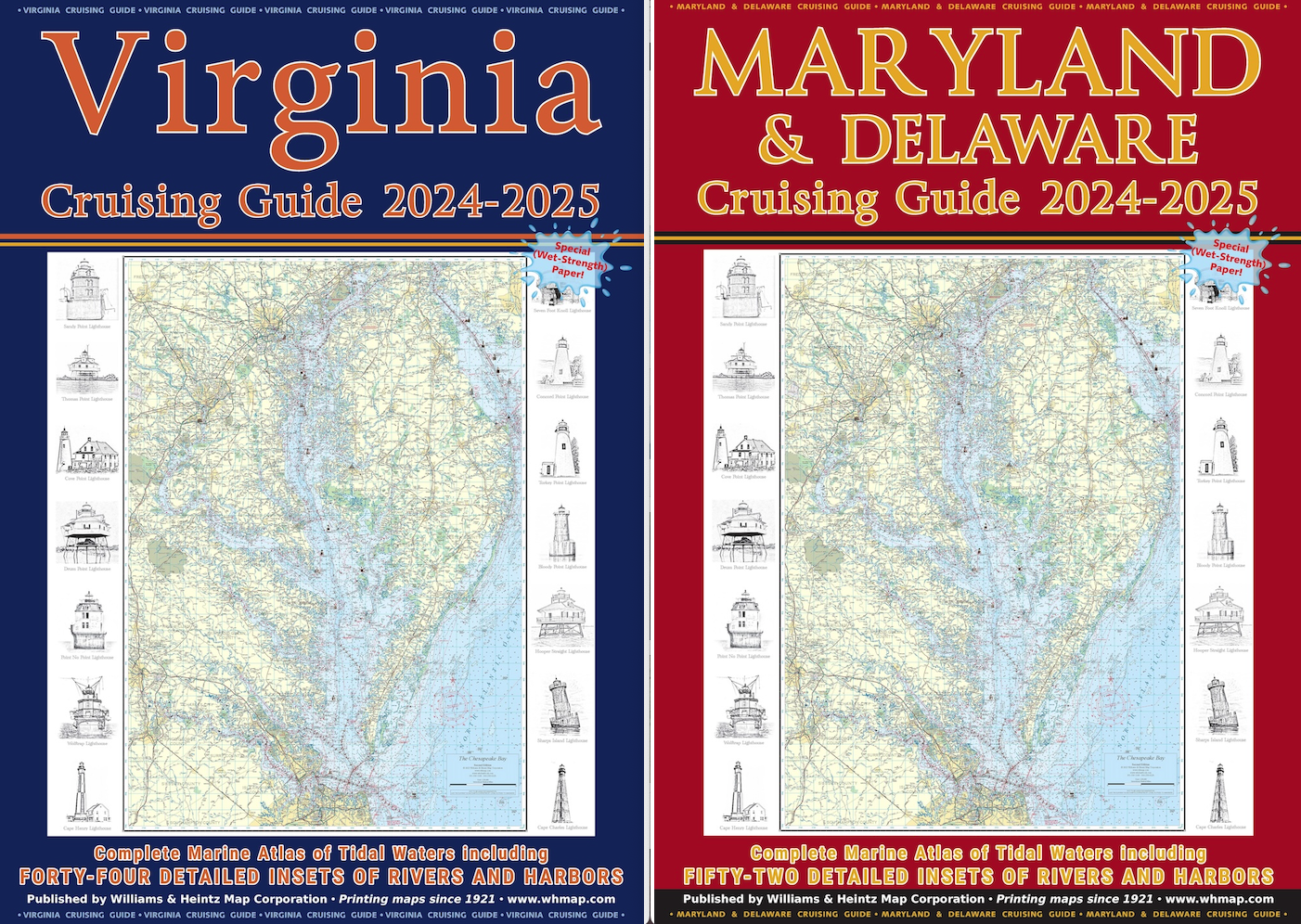
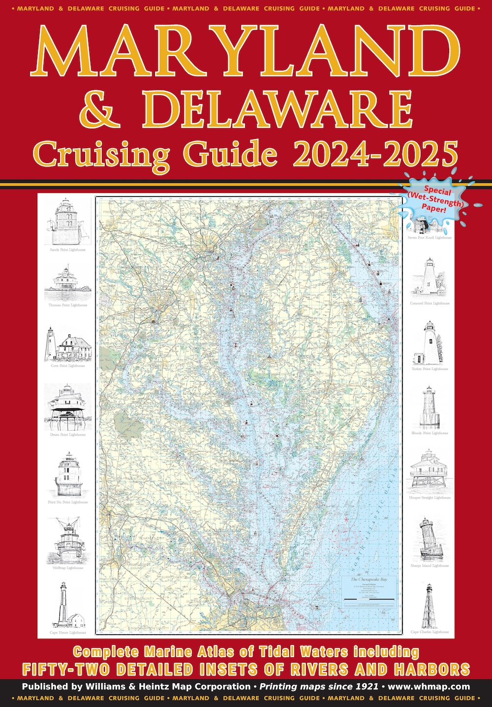
Our Maryland & Delaware Cruising Guide covers the Maryland area of the Chesapeake Bay, the Potomac River as far north as Washington, D.C., Delaware Bay to Cape May, and the Chincoteague Bay area.
$49.00
1
Secure PayPal Checkout
Ships from USA
Printed in the USA
Wet Strength Paper
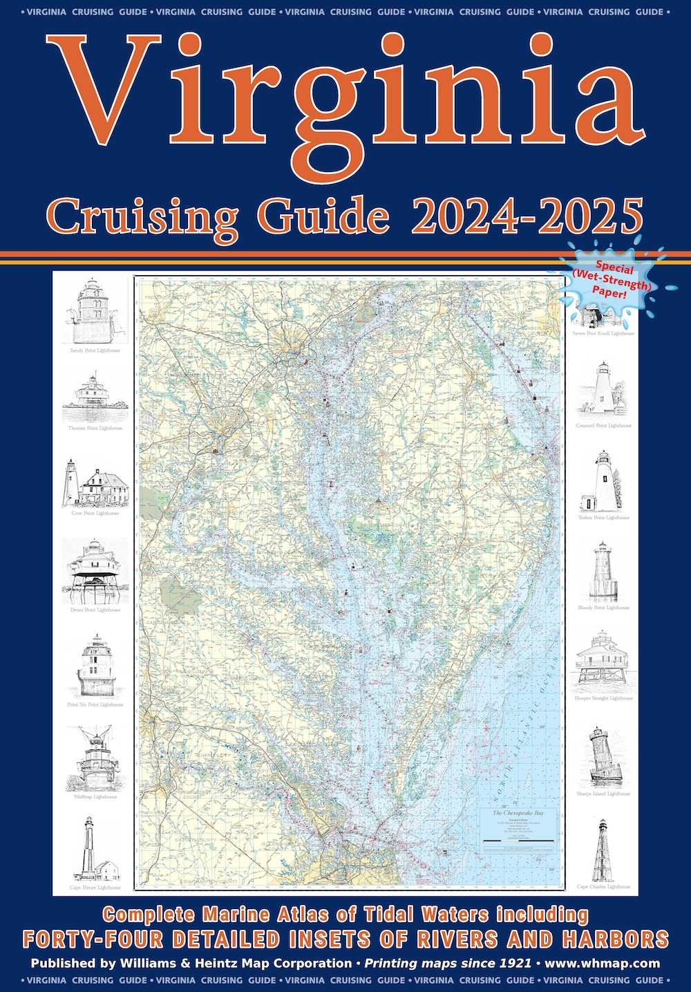
Description
Our Maryland & Delaware Cruising Guide covers the Maryland area of the Chesapeake Bay, the Potomac River as far north as Washington, D.C., Delaware Bay to Cape May, and the Chincoteague Bay area (includes a large scale inset of Ocean City). MD Charts 1 through 20 and DE Charts 1 through 8 are at a scale of 1:80,000. The 52 insets are in various scales from 1:40,000 to 1:20,000.
Williams and Heintz printed the very first “Guide for Cruising Maryland Waters” beginning in the early 1960’s for the Maryland Department of Natural Resources. In 1996, we took over as its publisher, renamed it under the title of Maryland Cruising Guide, and have continuously updated it since. In 2020, we added Delaware Bay to the book.
Printed on special Wet Strength paper using red-light readable ink. The chart books include a planning chart, tidal currents, course headings, towing services, and a detailed marina index. The cover is coated with an 8ml laminate and each chart book is enclosed in a heavy-duty vinyl sleeve to protect it from spray.
Features
- 52 detailed insets of rivers and harbors
- MD Charts 1–20 and DE Charts 1–8 at 1:80,000 scale
- Insets at various scales from 1:40,000 to 1:20,000
- Printed on Wet Strength paper — fully functional when wet
- Red-light readable ink for night navigation
- Includes planning chart, tidal currents, and course headings
- Detailed marina index and towing services directory
- Cover coated with 8ml laminate
- Enclosed in heavy-duty vinyl sleeve
- Includes QR code for free digital download of each chart
- Digitally compatible — works on iPhone, iPad, and Android
Specifications
ink: Red-light readable
cover: 8ml laminate
paper: Wet Strength
scale: 1:80,000
format: Cruising Guide / Chartbook
insets: 52
sleeve: Heavy-duty vinyl
edition: 2024–2025
de Charts: 1–8
md Charts: 1–20
printed In: USA
inset Scales: 1:40,000 to 1:20,000
Coverage Area
Maryland Chesapeake Bay, Potomac River to Washington D.C., Delaware Bay to Cape May, Chincoteague Bay area, and Ocean City (large scale inset).
Best For
Boaters cruising Maryland and Delaware waters — from weekend sailors on the Chesapeake to long-distance cruisers transiting Delaware Bay.