Cruising Guides
VA Cruising Guides
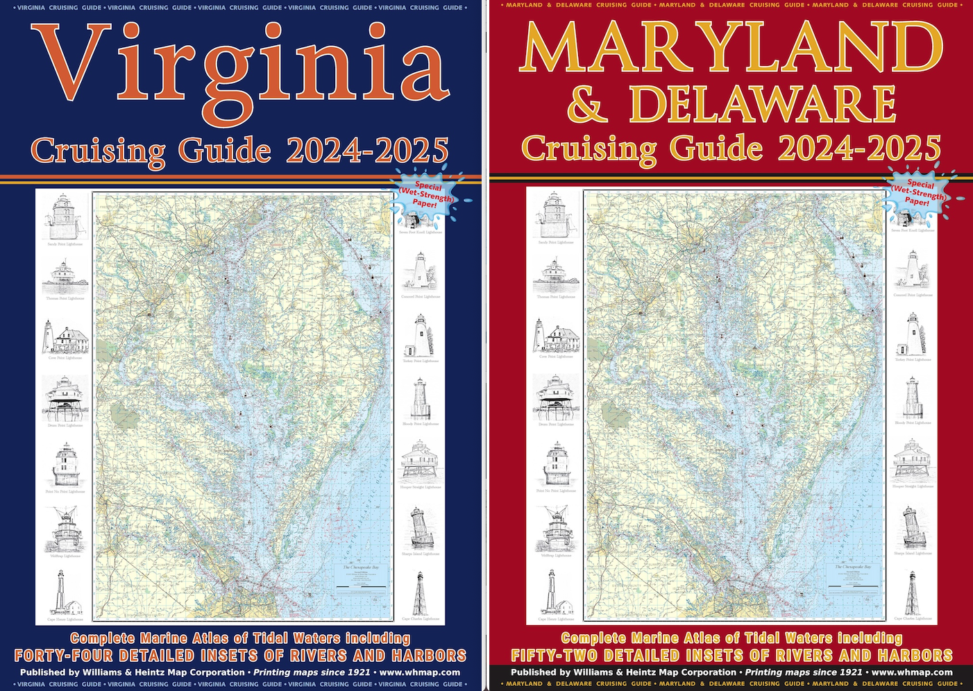
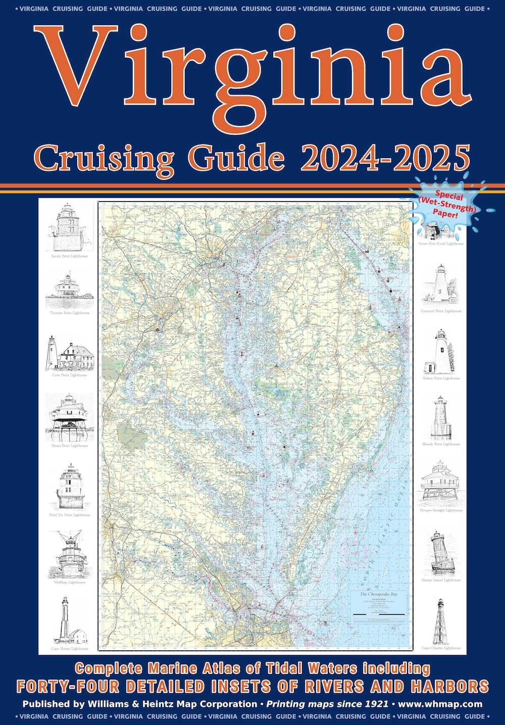
Our Virginia Cruising Guide covers Tidewater Virginia, southern Chesapeake Bay, Potomac River plus the Atlantic Ocean shores and bays.
$49.00
1
Secure PayPal Checkout
Ships from USA
Printed in the USA
Wet Strength Paper
Description
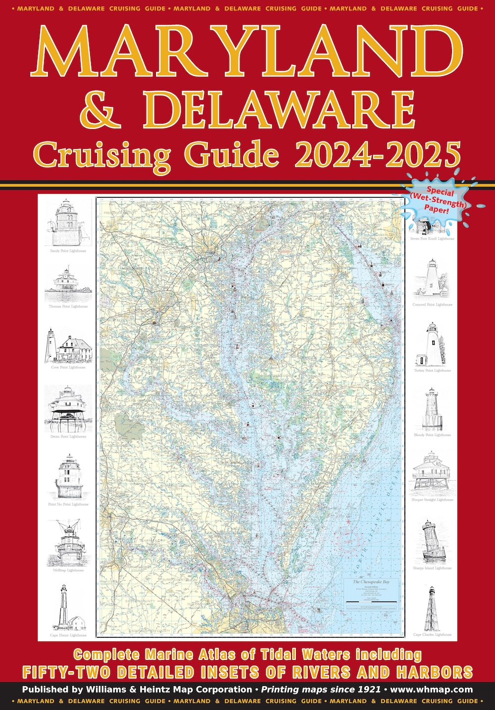
Our Virginia Cruising Guide covers Tidewater Virginia, southern Chesapeake Bay, Potomac River plus the Atlantic Ocean shores and bays. There are enlargements of Ocean City and Chincoteague Island. VA Charts 12 through 37 are at a scale of 1:80,000. The 44 insets are in various scales from 1:40,000 to 1:20,000.
Williams and Heintz updated the Virginia Cruising Guide in 2003 and has continued to refine it with each new edition. Like all our guides, it is compiled from the latest National Oceanic and Atmospheric Administration (NOAA) sources.
Printed on special Wet Strength paper using red-light readable ink. The chart books include a planning chart, tidal currents, course headings, towing services, and a detailed marina index. The cover is coated with an 8ml laminate and each chart book is enclosed in a heavy-duty vinyl sleeve to protect it from spray.
Features
- 44 detailed insets of rivers and harbors
- VA Charts 12–37 at 1:80,000 scale
- Insets at various scales from 1:40,000 to 1:20,000
- Enlargements of Ocean City and Chincoteague Island
- Printed on Wet Strength paper — fully functional when wet
- Red-light readable ink for night navigation
- Includes planning chart, tidal currents, and course headings
- Detailed marina index and towing services directory
- Cover coated with 8ml laminate
- Enclosed in heavy-duty vinyl sleeve
- Includes QR code for free digital download of each chart
Specifications
ink: Red-light readable
cover: 8ml laminate
paper: Wet Strength
scale: 1:80,000
format: Cruising Guide / Chartbook
insets: 44
sleeve: Heavy-duty vinyl
edition: 2024–2025
va Charts: 12–37
printed In: USA
inset Scales: 1:40,000 to 1:20,000
Coverage Area
Tidewater Virginia, southern Chesapeake Bay, Potomac River, Atlantic Ocean shores and bays, Ocean City, and Chincoteague Island.
Best For
Boaters cruising Virginia waters — from Hampton Roads and the James River to the Rappahannock, York, and southern Potomac.