Wall Charts
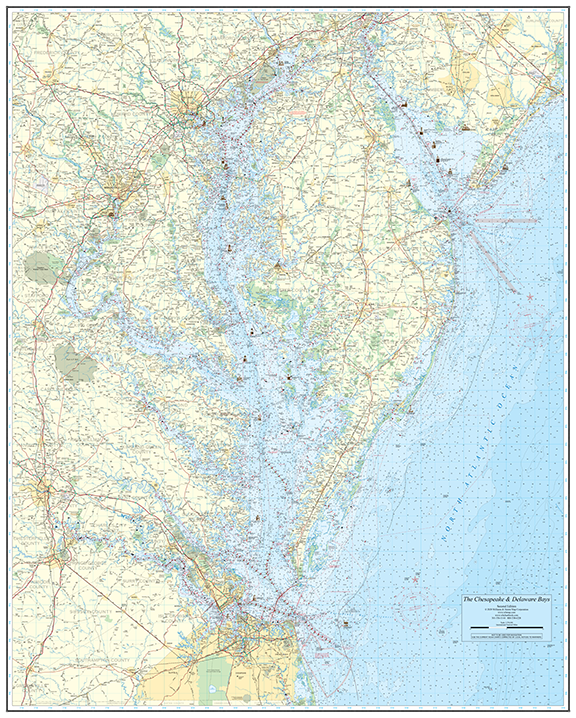
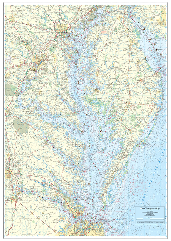
Chesapeake Bay Wall Chart – 37″ x 52″
A beautifully detailed 37″ x 52″ nautical wall chart of the Chesapeake Bay. Available on chart paper rolled, folded (+$10), or laminated (+$20).
$60.00
Chart paper, rolled in protective tube
1
Secure PayPal Checkout
Ships from USA
Printed in the USA
Wet Strength Paper
Description
The Chesapeake Bay Wall Chart offers a detailed overview of the entire Chesapeake Bay in a slightly more compact 37″ x 52″ format. Based on official NOAA cartography, it captures the Bay’s full navigational character — from the C&D Canal to the Bay Bridge-Tunnel.
This chart is printed on high-quality chart paper and makes an excellent addition to any boater’s home, office, or helm station. It provides enough detail for practical route planning while being easy to frame or mount.
Base price of $60 on chart paper, rolled. Add $10 for folded. Add $20 for durable lamination.
Features
- Covers the entire Chesapeake Bay
- Compact 37″ x 52″ format — easier to frame
- Based on official NOAA nautical cartography
- Available rolled, folded, or laminated
- Premium chart paper printing
- Great for home, office, or helm display
- Printed in the USA by Williams & Heintz
Specifications
size: 37″ x 52″
format: Wall Chart
based On: NOAA Nautical Charts
printed In: USA
Coverage Area
The entire Chesapeake Bay, from the C&D Canal to the Chesapeake Bay Bridge-Tunnel, including major tributaries.
Best For
Boaters who want a frameable, detailed wall chart of the Chesapeake Bay for planning and display.